Geology, Tectonics and Deep Structure of China

RUS

Table of contents.

– Introduction
– China Tectonics
– Characteristics and Mechanisms of Chinese Continental Tectonics
– Plate Tectonics of China
– The collision between the Indian subcontinent and the Eurasian continent
– Seismic Tomography Imaging of China Deep Structure
– References
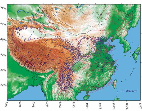
Horizontal velocity field in continental China, derived from global positioning system (GPS) data, with respect to stable Eurasia plate. Blue and black arrows are data from the Crustal Motion Observation Network of China (CMONOC) and non-CMONOC networks, respectively.

China is located in one of the most complicated tectonic areas in the world. Three Precambrian cratons (Sino-Korean, Tarim, Yangtze-Cathaysian) and the intervening Paleozoic accretionary and collisional folded belts (The Huanan Caledonides, Ogchean belt, The Tan-Lu fault, Honam fault) constitute the tectonic backbone of China.
Continue reading “Geology, Tectonics and Deep Structure of China”

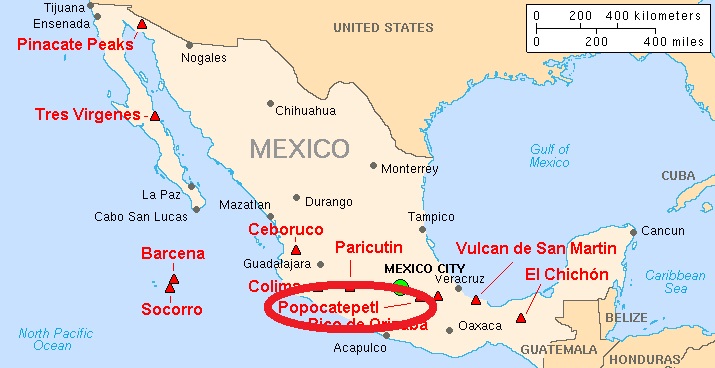
Impressive Eruption of Active Popocatepetl Volcano. Mexico.2016 – 2017.

Volcanoes of Mexico (42 volcanoes):
Baja California, NW Mexico & Mexican Islands (16 volcanoes): Bárcena | Cerro Prieto | Comondu-La Purisima | Coronado | El Aguajito | Guadaloupe | Isla San Luis | Isla Tortuga | Jaraguay | Pinacate | Punta Pulpito | San Borja | San Quintin | Socorro | Tres Virgenes | unnamed
Western & Central Mexico (24 volcanoes): Ceboruco | Chichinautzin | Colima | Durango | Iztaccíhuatl | Jocotitlán | La Gloria | La Malinche | Las Cumbres | Los Atlixcos | Los Azufres | Los Humeros | Mascota | Naolinco | Nevado de Toluca | Papayo | Paricutín (Michoacán-Guanajuato) | Pico de Orizaba | Popocatépetl | San Martín | Sangangüey | Serdán-Oriental | Sierra la Primavera | Zitácuaro-Valle de Bravo
Southern Mexico (2 volcanoes): El Chichón | Tacana

Baja California: a mountainous peninsula in northwestern Mexico that extends southward from the border with California and separates the Gulf of California from the Pacific Ocean. It consists of two states of Mexico: Baja California (capital, Mexicali) and Baja California Sur (capital, La Paz).


Chiapas, Mexico. Internal Structure. Mantle.


Tectonic setting.

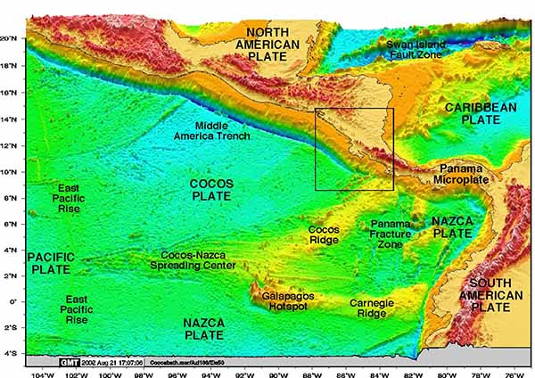
Southern Mexico is a very interesting area where the subducting Cocos slab drastically changes its geometry: from a flat slab in Central Mexico to a ~ 45° dip angle beneath Chiapas. Also, the currently active volcanic arc, the modern Chiapanecan volcanic arc, is oblique and situated far inland from the Middle America trench, where the slab depth is ~ 200 km.

Continue reading “Chiapas, Mexico. Internal Structure. Mantle.”

Deep strong earthquake in Chiapas, Mexico. 2017


Introduction

The 2017 Chiapas  earthquake struck at 23:49 CDT on 7 September in the Gulf of Tehuantepec off the southern coast of Mexico, near state of Chiapas, approximately 87 kilometres (54 mi) south of Pijijiapan, with a Mercalli intensity of IX (Violent).  The magnitude was estimated to be Mw 8.1.
The earthquake caused some buildings in Mexico City to tremble, prompting people to evacuate. It also generated a tsunami with waves of 1.75 metres (5 ft 9 in) above tide level; and tsunami alerts were issued for surrounding areas.  It was also the second strongest recorded in the country’s history, behind the magnitude 8.6 earthquake in 1787, and the most intense recorded globally, so far in 2017.


Continue reading “Deep strong earthquake in Chiapas, Mexico. 2017”

Central America Tectonic Setting


Introduction

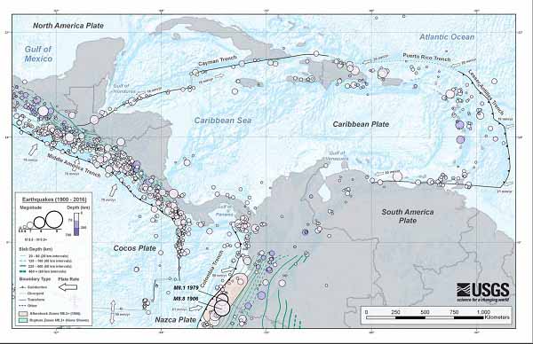
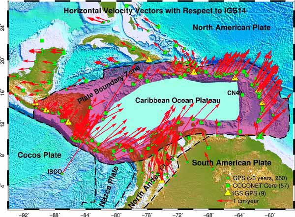
Extensive diversity and complexity of tectonic regimes characterizes the perimeter of the Caribbean plate, involving no fewer than four major plates (North America plate, South America plate, Nazca plate, and Cocos plate). Inclined zones of deep earthquakes (Wadati-Benioff zones), ocean trenches, and arcs of volcanoes clearly indicate subduction of oceanic lithosphere along the Central American and Atlantic Ocean margins of the Caribbean plate. While crustal seismicity in Guatemala, northern Venezuela, and the Cayman Ridge and Cayman Trench indicate transform fault and pull-apart basin tectonics.

Continue reading “Central America Tectonic Setting”