Seismotectonics.

Seismotectonics is the scientific discipline that studies the geological conditions of earthquakes. It seeks to understand which faults are responsible for seismic activity in an area by analysing a combination of regional tectonics, recent instrumentally recorded events, accounts of historical earthquakes and geomorphological evidence.
Systematic seismotectonic research began in the 1960’s and 1970’s. Such research serves as a basis for work in seismic zoning and to quantify the seismic hazard of an area.
The relation between geological characteristics and the occurrence of earth¬quakes started to be studied at the end of the 19th century and very early on in the 20th century. The term seismotectonics began to be used around 1910 by Sieberg and Hobbs and is applied to the characteristics of the occurrence of earthquakes in data. During the 1960s, plate tectonics theory, in whose development seismologic data played an important role, was introduced. Modern seismotectonics studies are based on its principles.
As most earthquakes arise from stress build-up due to deformation of the earth's crust, understanding of seismicity depends heavily on aspects of geology, which is the science of the earth's crust, and also calls upon knowledge of the physics of the earth as a whole, i.e. geophysics. The particular aspect of geology which sheds most light on the source of earthquakes is tectonics, which concerns the structure and deformations of the crust and the processes which accompany it; the relevant aspect of tectonics is now often referred to as seismotectonics.
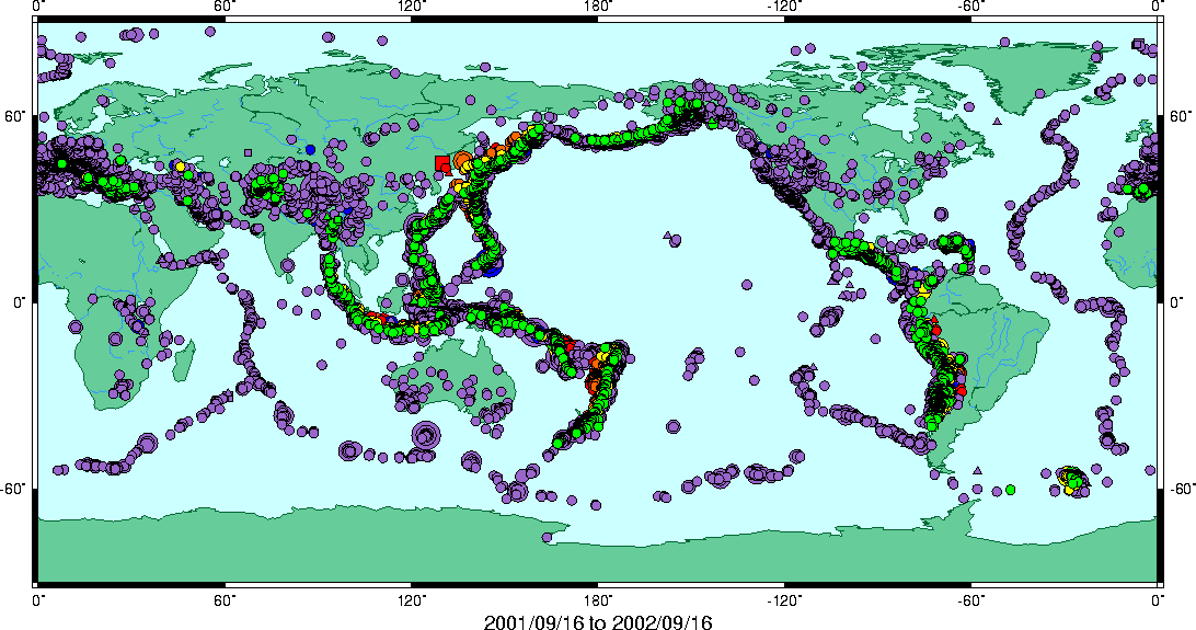
On a global scale, the present-day seismicity pattern of the world is illustrated in general terms by the seismic events (seismotectonics). Most of these events can be seen to follow clearly defined belts which form a map of the boundaries of segments of the earth's crust known as tectonic plates.
The chief objects of seismotectonic research are the epigeosynclinal orogens of the Alpine and Pacific Ocean foldings, which arose against the background of Mesozoic and Cenozoic geosynclines; geosynclines currently in the phase of the initial orogenic process; epicratonic orogens—areas of Anthropogenic activation of tectonic movement within previously consolidated structures; modern continental and oceanic rifts; Benioff zones; and sectors of intensive manifestation of recent tectonic movements. microzoning.
Seismotectonic map showing the geology, geomorphology, water features, faults, lineaments, shear zone and past earthquake events. Seismicity of an area is the basic issue to be examined in seismic hazard analysis for evaluating seismic risk for the purpose of microzonation planning of urban centers. Detailed knowledge of active faults and lineaments and associated seismicity is required to quantify seismic hazard and risk.

