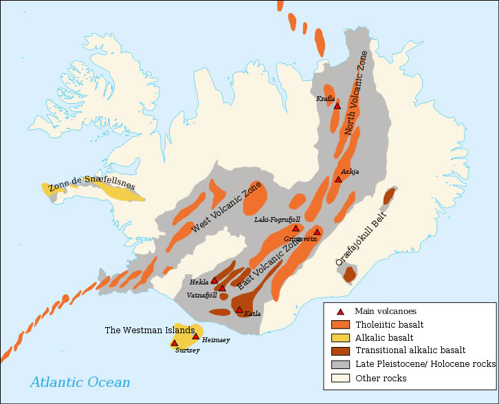
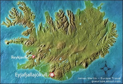
Eyjafjallajokull (63°38′N 19°36′W; Area 100 km2 /40 sq mi, Summit Elevation: 1666 m 5,466 feet; Volcano Type: Stratovolcano; location: Southern Iceland) (also known as Eyjafjöll) is located west of Katla volcano. Eyjafjallajökull consists of an E-W-trending, elongated ice-covered stratovolcano with a 2.5-km-wide summit caldera. Fissure-fed lava flows occur on both the eastern and western flanks of the volcano, but are more prominent on the western side. Although the 1666-m-high volcano has erupted during historical time, it has been less active than other volcanoes of Iceland's eastern volcanic zone, and relatively few Holocene lava flows are known. An intrusion beneath the south flank from July-December 1999 was accompanied by increased seismic activity and was constrained by tilt measurements, GPS-geodesy and InSAR. The last historical eruption of Eyjafjallajökull prior to an eruption in 2010 produced intermediate-to-silicic tephra from the central caldera during December 1821 to January 1823.

Around December 2009, seismic activity was detected in the volcano area, with thousands of small earthquakes (mostly magnitude 1–2 on the Richter magnitude scale, with only a couple greater than 3 magnitude) 4.3–6.2 mi beneath the volcano.
On 26 February 2010, unusual seismic activity along with rapid expansion of the Earth's crust was registered by the Meteorological Institute of Iceland. This gave geophysicists evidence that magma was pouring from underneath the crust into the magma chamber of the Eyjafjallajokull volcano. The seismic activity continued to increase and from 3–5 March, close to 3,000 earthquakes were measured at the epicenter of the volcano.
The eruption is thought to have begun on 20 March 2010, about 5.0 mi east of the top crater of the volcano in a popular hiking region called Fimmvorduhals. This first eruption, in the form of a fissure vent, did not occur under the glacier and was smaller in scale than had been thought by some geologists.

On 14 April 2010 Eyjafjallajokull resumed erupting after a brief pause, this time from the top crater in the center of the glacier, causing melt water floods to rush down the nearby rivers. This eruption was explosive in nature and is estimated to be ten to twenty times larger than the previous one in Fimmvorduhals. This second eruption threw volcanic ash several kilometers up in the atmosphere which led to air travel disruption in northwest Europe for six days from 15 April 2010, including the closure of airspace over most of Europe. The eruptions also created rare electrical storms.
Eyjafjallajokull and Katla
Eyjafjallajökull lies 25 km west of another subglacial volcano, Katla, which is much more active and known for its powerful subglacial eruptions and its large magma chamber. Each of the eruptions of Eyjafjallajokull in 920, 1612, and 1821-1823 has preceded an eruption of Katla. Katla has not displayed any unusual activity (such as expansion of the crust or seismic activity) during the 2010 eruptions of Eyjafjallajokull, though geologists have been concerned about the general instability of the larger volcano since 1999. Some geophysicists in Iceland believe that the Eyjafjallajokull eruption may trigger an eruption of Katla, which would cause major flooding due to melting of glacial ice and send up massive plumes of ash.

